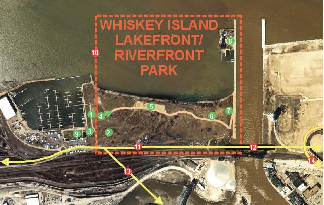
Map of Whiskey Island showing existing and proposed features
What do the numbers mean? Move cursor over each number to find out.
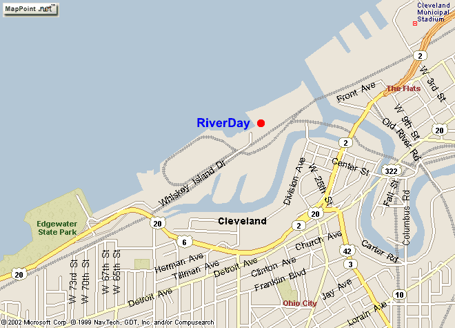
Celebrate RiverDay 2003 -- Whiskey Island -- Saturday May 31, Noon-6pmMark your calendar for the Friends of the Crooked River's 13th annual RiverDay on Saturday May 31,2003. Last year's theme was - "When it rains..." - (which it did that day!) Nevertheless hundreds braved the cold rain to make the day a success.
This year there's good news to report. Last July, Mayor Campbell proposed a park on Whiskey Island within two years! Finally, there is a commitment allowing us to enjoy this unique urban park setting, where our river greets our lake. Prior to the mayor's announcement, the only plan for the eastern end of Whiskey Island was to expand the Cleveland-Cuyahoga County Port Authority. The Cuyahoga County Planning Commission also recognized the greenspace on Whiskey Island as park in the Cuyahoga County Greenspace Plan. The Greenspace Plan was based on public meeting comments to link and add greenspace in the county. After fifteen public meetings the Greenspace Plan was completed and approved by the planning commission's board of directors. The LPAC consultant's released the draft "Framework Plan" that shows the 20 acres on Whiskey Island as a park and a pedestrian bridge linking Whiskey Island to the eastside at the mouth of the Cuyahoga River. However, the consultant's plan shows Whiskey Island Marina being shutdown to allow for expansion of the Port Authority. The marina provides 10 acres of public access to the 500-recreational-boat facility. Also, the proposed plan does not have any direct trail linkage between Whiskey Island and Edgewater Park less than a mile down the road. Along with the success to realize Whiskey Island as a park, there are concerns being raised about the new iron ore transfer station on Whiskey Island. The iron ore transfer station will increase the amount of large ore boat traffic in front of the proposed park by up to 250 boats. That equates to approximately 500 ore boat movements that will re-suspend the contaminated sediments in the Cleveland Harbor. This will have a negative affect on the water quality at Whiskey Island and Edgewater Beach about a mile down the shore. For more information on RiverDay events, visit http://www.cuyahogariver.org
CELEBRATE RIVERDAY ON WHISKEY ISLAND - SATURDAY, MAY 31st, 2003 Feel free to stay and watch the sunset! |
Map of Whiskey Island showing existing and proposed features
What do the numbers mean? Move cursor over each number to find out.